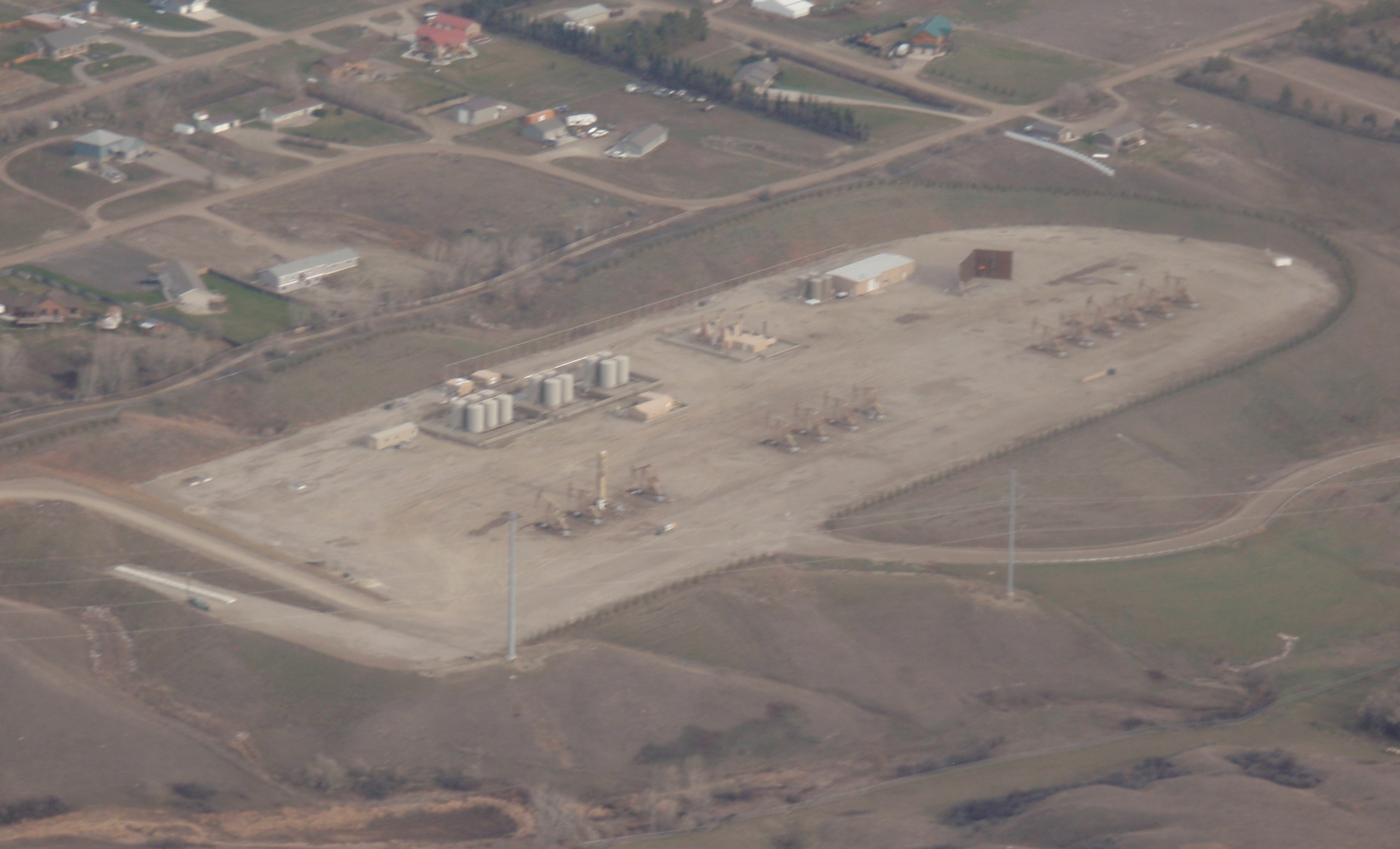
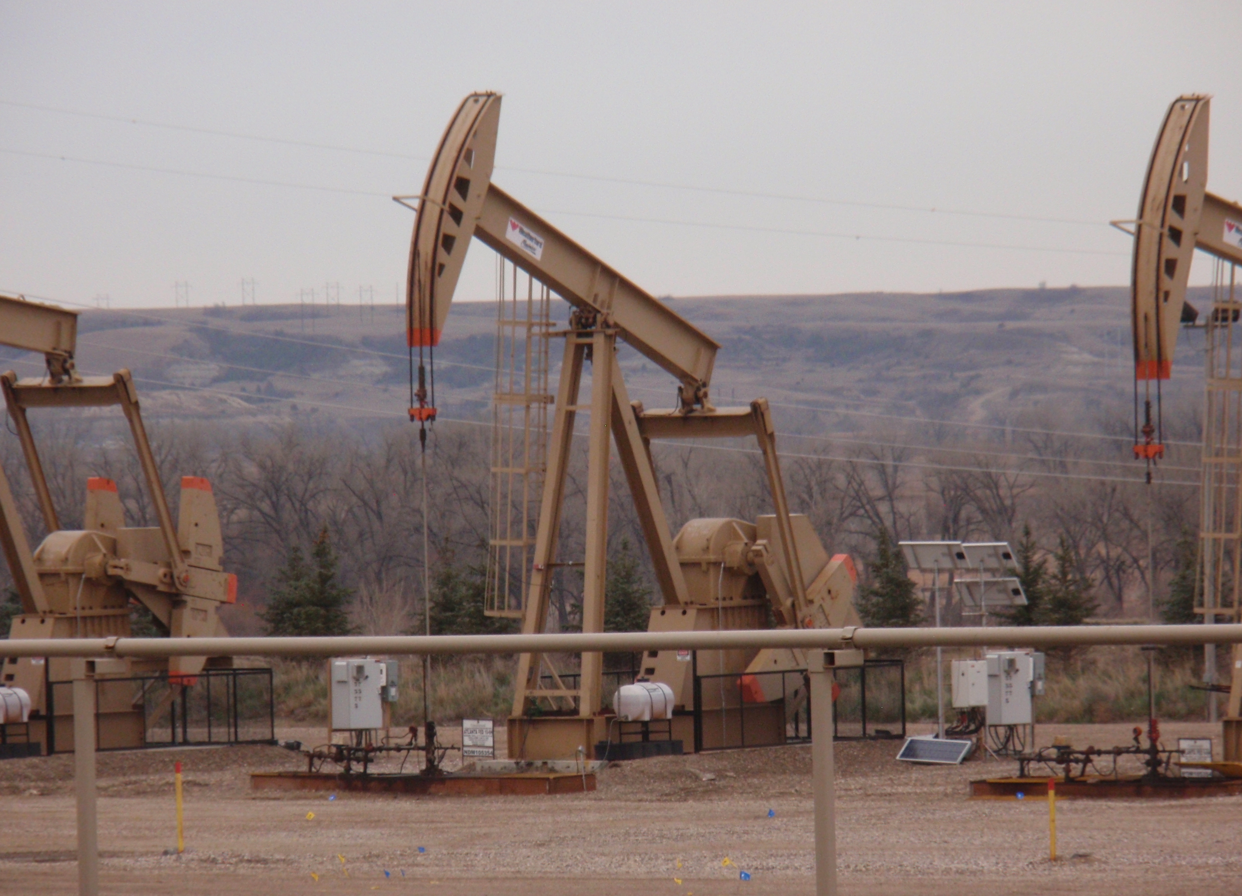
There is one site southwest of Williston that holds 14 working wells. They are referred to as the Atlanta wells. Check out the photo above and following.
If you want to find these things, the address is 4750 141st Ave. NW, Williston. Coordinates are 48.109623, -103.729930 if you want to look them up on Google maps. It is immediately to the north of the Missouri River close to the bridge on U.S. 85 crossing the river.
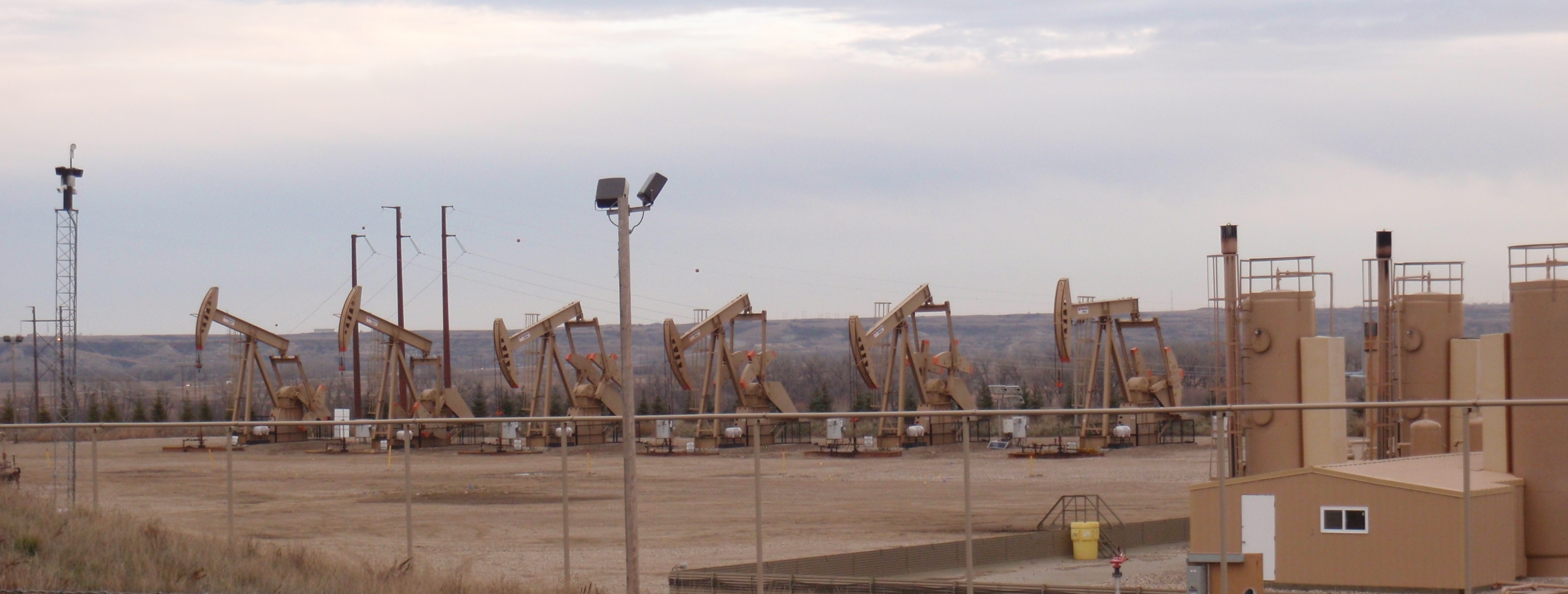
On my trip to Williston over Thanksgiving 2016 I was able to take some aerial pictures since I flew in on United flight from Denver, meaning we flew in to Williston from the south. I was also able to drive out to the site and take pictures from a public road immediately north of the site.
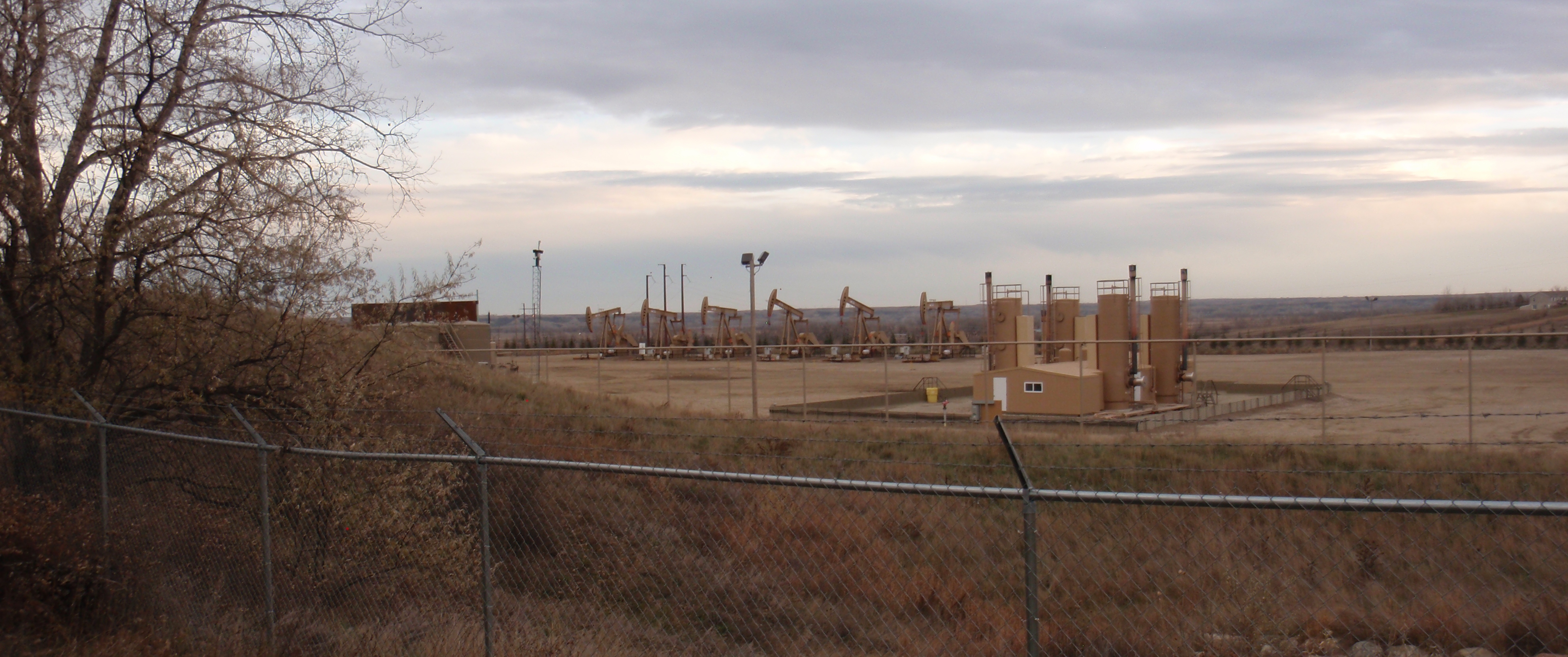
The Million Dollar Way has been following these wells for several years. I will mention a number piece of information from the following posts:
- originally dated 4/2/13 with multiple updates since then – Fourteen CLR Wells In Section 6-153-101, Baker Field, Southwest of Williston — Case No 20154, April Hearing Dockets; 14-Well Array
- 1/1/14 – Update On The Atlanta Wells, Baker Oil Field, Southwest Of Williston Near The River
The 14 wells, along with a salt water disposal well, were developed simultaneously, an early illustration of the multi-well pad concept. According to the MDW posts, two wells were spud in 11/12 with testing in 4/13. Most of the drilling finished in 3/14.
GIS map
Today I learned how to drive the GIS map server at the North Dakota Industrial Commission, Department of Mineral Resources website. That is an astoundingly impressive capability.
As an aside, check it out for the phenomenal capabilities that exist with modern technology. A decade or two ago getting that information required going to the agency’s office and pouring through hundreds of pages of paper reports.
As another aside, one of the reasons I blog is to learn. Today I learned how to use the GIS map server which is an incredibly amazing tool which is also a lot of fun to explore. Can you tell I’m having a blast blogging?
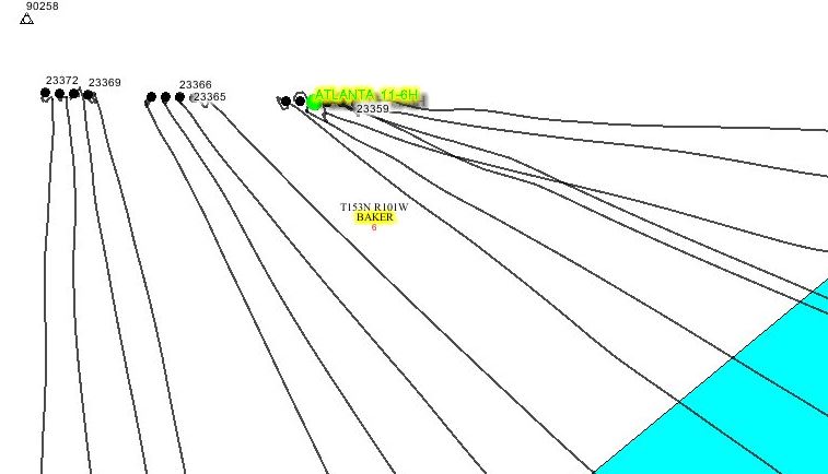
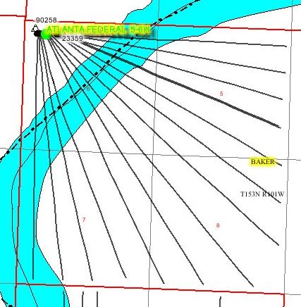
So here is a zoomed in view of where those 14 wells are drawing oil. Notice the map traces the exact location of the well. Yet one more astounding thing to me is how the geology wizards can make that well twist and turn and go any direction they want. As a brain stretcher for me, keep in mind that every time the pipes are replaced, the drilling bit is replaced, fracking explosives are lowered down into the well, or the plug that concentrates the explosion is drilled, all of the equipment follows those meandering paths down and back up again. Astounding. (I’m running out of superlative adjectives.)

Take a look for yourself and you can confirm what MDW mentioned – well 23362 has two laterals feeding out from it. There are seven laterals from those six wells on the right side. That tells my simple brain that the oil wizards drilled two different lines off this one well. That means one well is drawing from 4 miles of exposed pipe around 2 miles underground.
Here’s a little larger view of the laterals heading out from the wells.
Finally, here is a view showing the full laterals. Notice that from this one pad oil is drawn from two different layers over an area of 4 square miles. That is called a 2560 acre spacing unit. Those 15 laterals are going down 10,000 feet and then spreading out to cover four square miles.
Yet one more astounding thing I learned from looking at the GIS map server is that some sections have a lot of wells drilled on them yet there are even more sections with only one well.
What’s the deal?
The deal is that every section of land which shows one well will eventually have 5 or 10 or 15 wells on it. The producing well locks up the lease for the lifetime that well is in production. This gives the drillers a really, really long time to finish all the potential drilling that could be done.
This also illustrates the concept that there’s far more drilling yet to be done than all the drilling that has been completed to this point.
To give a visual, consider the following view. The 14 well Atlanta site is in the bottom left corner; look for the fan shape. Notice how densely some sections have been drilled and how many sections have only one well.
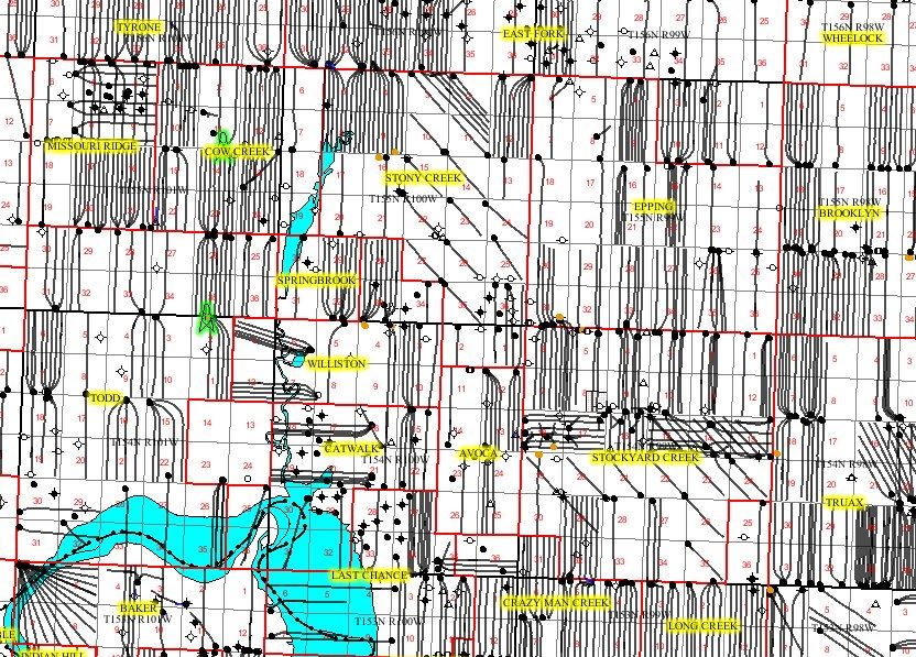
There is a whole lot more drilling yet to be done. That is a whole lot, as in several decades worth of drilling at the pace of 2013 and 2014. I’ll make a guess at over a half century of drilling with the rig count in play at the moment.
Final post describes the production data from the wells and gives my guess of the value for that production.
My family had the minerals rights on the site they are drilling to.
Hi Mike:
Thanks for commenting and thanks for reading.
Jim